Thawing permafrost decoded by breakthrough Swiss research
For the first time a research team in Switzerland has measured how much of the Alpine permafrost has thawed. Their technique helps scientists understand how climate change is affecting mountains’ permanently frozen ground and improves the prediction of landslides and rockfalls.

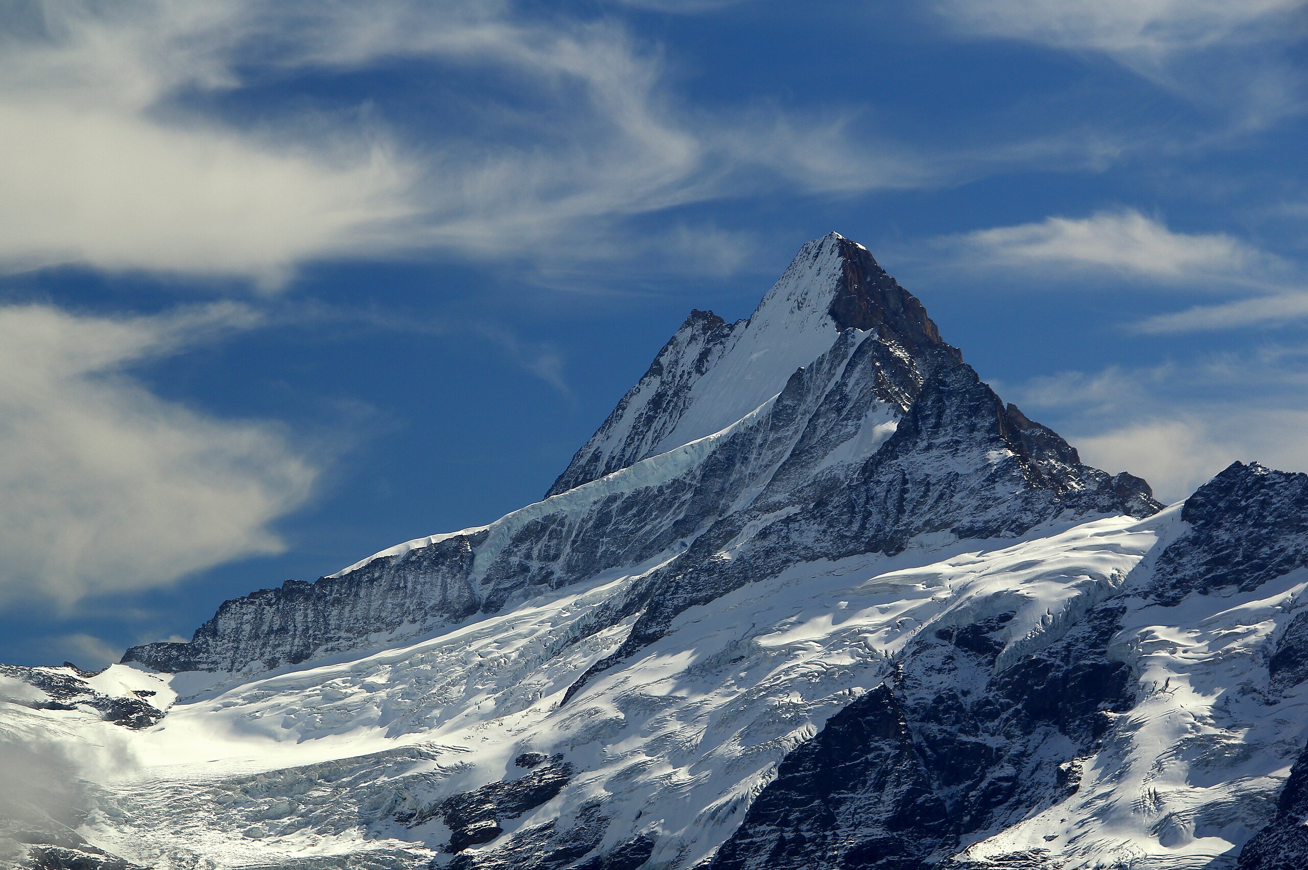
Just after 9:30am on August 23, 2017, a huge landslide broke off from the face of Pizzo Cengalo, a mountain in the Alps on the Swiss-Italian border. More than three million cubic metres of rock material mixed with water collapsed towards the valley, killing eight people and submerging part of the Swiss village of Bondo in the valley below.
The Bondo landslide was one of the largest in Switzerland in more than a century. Seven years later, the justice system is still evaluating to what extent the authorities should be held responsible for what happened to the victims. But it’s clear that a changing climate caused by human activities contributed to the catastrophe.
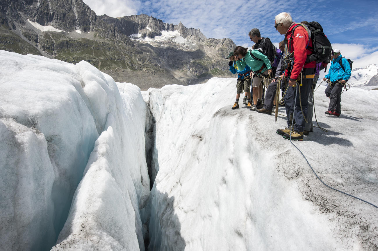
Images of rapidly melting Swiss glaciers, which have lost 10% of their volume in just two years, are among the most visible effects of climate change. However, it is not only glaciers that are suffering from the heat. The unseen permafrost layer – soil whose temperature is consistently below freezing – is also thawing fast. The recent heatwave in Switzerland and the hot summer days in the Alps over the past two decades are accelerating the phenomenon.
Permafrost, which occurs in the Alps above 2,500 metres, covers nearly a quarter of the Earth’s surface and makes up about 5% of the land in Switzerland. This layer formed by ice, rock and soil acts as a kind of glue that stabilises otherwise insecure mountain slopes.
“We get a three-dimensional image of the permafrost. It’s like doing a tomography of the soil.”
Christian Hauck, University of Fribourg
When the ice within it melts, the risk of natural hazards such as the one seen in Bondo increases. “It is therefore important to be able to measure permafrost and monitor its evolution,” says Christian Hauck, professor of physical geography at the University of Fribourg.
Switzerland is a pioneering country in permafrost research. It established the first national monitoring network (PERMOSExternal link) in 2000, and the series of measurements begun in 1987 on Piz Corvatsch in eastern Switzerland is the longest running in the world for mountain permafrost.
Recently, Swiss permafrost measurement reached another milestone when Hauck and his research group developed a new measurement method to quantify soil ice loss. It’s a method that can be used not only in the Alps but also in the Arctic, where thawing permafrost can release powerful greenhouse gasesExternal link into the atmosphere, accelerating climate change.
Mapping soil to measure ice in permafrost
In a method used worldwide, researchers drill holes in the ground up to 100 metres deep to study the evolution of permafrost by measuring its temperature. In Switzerland, this takes place at more than 20 locations in the AlpsExternal link, where the permafrost is warming by about 1°C per decade. But drilling boreholes is complicated and expensive, especially at high altitudes, and they don’t allow for detection of the amount of ice.
Another technique involves passing an electric current between electrodes placed at the surface and measuring electrical resistivity (how strongly it resists electric current). The more ice in the ground – which conducts electricity less well than water – the higher the resistivity.
Now, the University of Fribourg research group has combined the resistivity approach with the use of seismic sensors, in which an acoustic signal is sent into the soil.
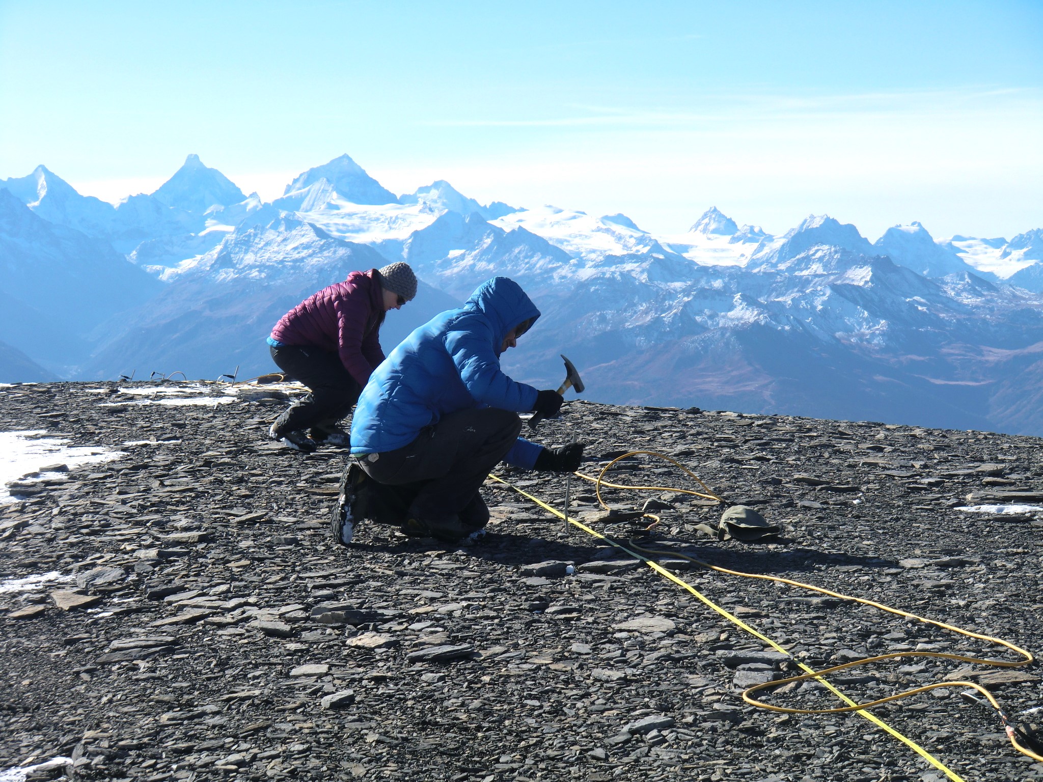
The data they collect, together with temperature data, make it possible to measure permafrost over large areas and calculate the amount of ice within it, Hauck explains. “We get a three-dimensional image of the permafrost. It’s like doing a tomography of the soil,” he says.
How hot summers affect permafrost
Measurements taken at 3,410 metres above sea level on the slopes of the Stockhorn, a mountain near the Matterhorn in canton Valais, southwestern Switzerland, showed that the Alpine permafrost in the region lost about 15%External link of its ice between 2015 and 2022.
“This is the first time we have quantified the loss of ground ice within the permafrost, so we can’t say whether that’s a lot or a little,” Hauck explains.
But the hottest days of summer are clearly having a negative impact. Periods of extreme temperatures – even over a short time – increase the thickness of the so-called active layer, the surface layer above the permafrost that thaws during summer and refreezes in winter.

The heat then spreads deeper and melts the ice contained in the permafrost. According to a recent analysisExternal link of data collected across Europe, a single hotter-than-average summer, such as that of 2022, may be enough to cause irreversible loss of permafrost in the mountains.
Alpine permafrost has already reached the point of no return
Permafrost’s “point of no return” comes when the summer thaw can no longer be compensated for by the freezing in the winter and only a significant change in climate would restore the original conditions.
Winter’s cold can no longer penetrate deep enough, and the ice contained in the ground is melting faster and faster, Hauck explains. Permafrost, he believes, has already reached a tipping point, or is close to doing so, in many parts of the Alps.
Depending on geological conditions, the disappearance of permafrost can lead to increased landslides and rockfalls in places where they were not previously possible. Rockfalls pose a threat to mountain hikers and to infrastructure built on permafrost, such as Alpine huts, ski lifts and avalanche barriers.
Having measurement methods that can reliably anticipate the tipping points of permafrost will help improve our ability to predict natural hazards, according to Hauck.
Swiss measurement system is also useful in the Arctic
The techniques developed in Switzerland are also directly applicable for studying permafrost change in the Arctic, says Ylva Sjöberg, professor of ecology and environmental science at Umeå University in Sweden. For example, they can be useful in better understanding abrupt thaw slumps or landslides caused by thawing permafrost, which are difficult to study by other methods, she wrote by email.
Thawing permafrost in the Arctic can damage infrastructure such as roads, gas pipelines and power grids, affecting millions of peopleExternal link from Russia to Canada. It could also reactivate ancient microorganisms trapped in the ice.
Most importantly, it can release large amounts of greenhouse gases into the atmosphere that would further exacerbate global warming. Craters formed by thawing permafrost and land collapse fill with water. These new lakes are an ideal habitat for bacteria that degrade the organic matter embedded in permafrost, producing CO2 and methane (CH4) – both greenhouse gases.

Theoretically, says Bernd Etzelmüller, who heads the Department of Geosciences at the University of Oslo in Norway, the measurement technique developed in Switzerland could identify massive ice bodies in permafrost and pinpoint places that could release greenhouse gases. “The methodology is universal, as are the physical processes of permafrost,” he says.
Permafrost thaw is a slow evolution
Despite the research in the Alps and the Arctic, the study of how permafrost interacts with climate change, as well as the consequences of its thawing, is still lacking.
“What happens if permafrost thaws? Does the soil become wetter because there is more water or drier because the thawing water is drained and evaporates due to global warming? We don’t know exactly yet,” says Christian Hauck.
However, it is known that permafrost reacts more slowly to climate change than glaciers and should therefore continue to exist for longer. “There will probably still be some in 150 or 200 years,” he says.
In the meantime, though, its slow thaw will put more places like the village of Bondo at risk of natural disasters, making permafrost monitoring essential in the decades and centuries to come.
Edited by Veronica DeVore/ts

More
How centuries of Swiss emigrants left their mark on the US

More
Switzerland’s struggle: balancing architecture, densification and heritage

More
How a Swiss banknote’s life comes to an end

More
What’s behind a CEO’s paycheck in Switzerland

More
Thawing permafrost decoded by breakthrough Swiss research


In compliance with the JTI standards
More: SWI swissinfo.ch certified by the Journalism Trust Initiative
You can find an overview of ongoing debates with our journalists here . Please join us!
If you want to start a conversation about a topic raised in this article or want to report factual errors, email us at english@swissinfo.ch.